1
Active Storms1
Hurricanes1
Major (Cat 3+)Above Normal
Activity LevelActive Tropical Systems
Hurricane Ian
Category 4 - 155 mph (936 mb)
Location: 26.5°N 82.0°W
Movement: NNE at 10 mph
Approaching Florida west coast with catastrophic impacts expected
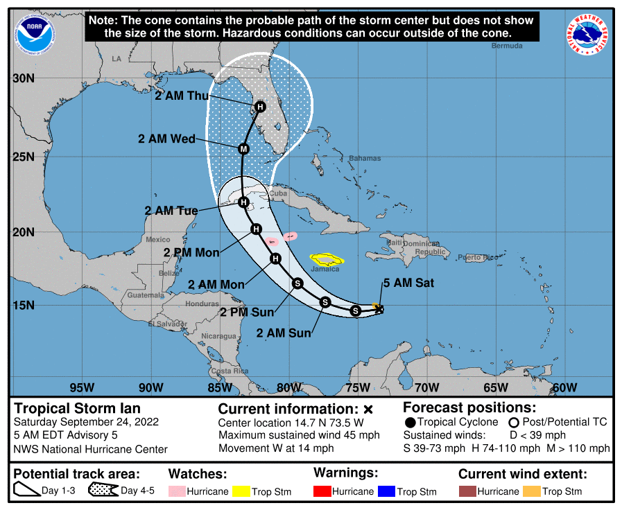
Atlantic Basin Outlook
Hurricane Ian continues to intensify as it approaches the Florida west coast. Catastrophic storm surge of 12-18 feet is expected along the coast from Englewood to Bonita Beach. No other tropical cyclone activity is expected in the Atlantic basin during the next 5 days.
Model Consensus Analysis
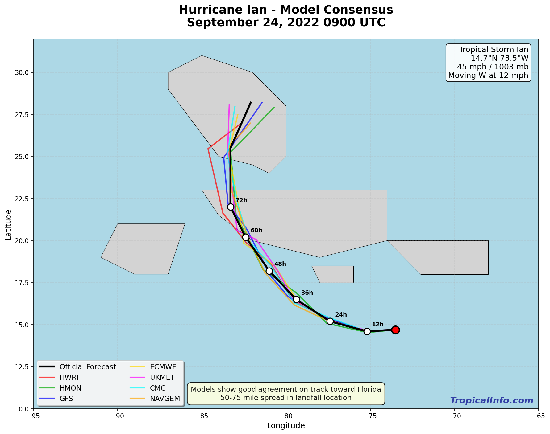
Models are in excellent agreement on Ian making landfall near Fort Myers, Florida as a major hurricane. Track spread is only 50-75 miles at landfall.
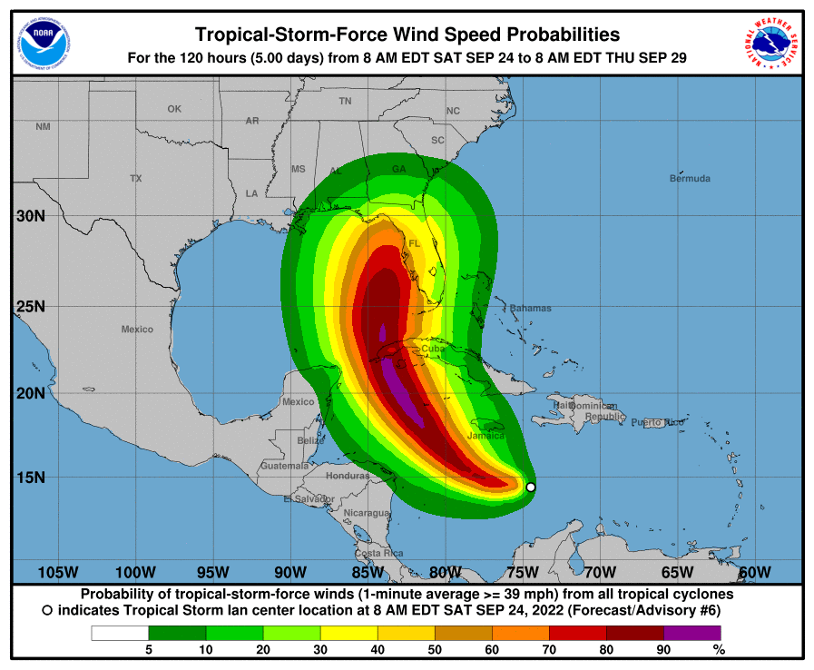
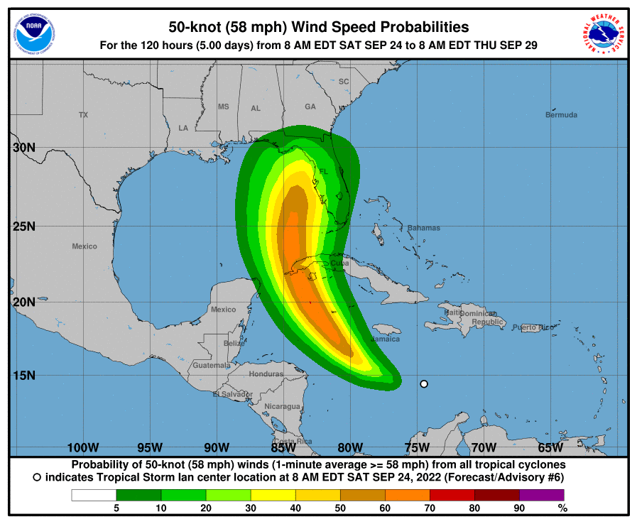
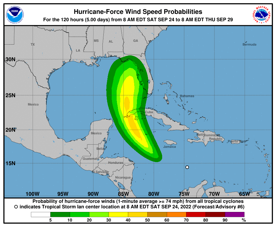
Wind Probability Analysis
Environmental Analysis
SSTs remain very warm (30-31°C) along Ian's path, providing ample fuel for continued intensification until landfall.
Low to moderate shear (10-15 kt) remains favorable for Ian to maintain major hurricane intensity through landfall.
Latest Reconnaissance Data
NOAA Aircraft Mission Summary (1200 UTC):
- Maximum Flight Level Winds: 167 mph
- Minimum Central Pressure: 936 mb (extrapolated)
- Eye Diameter: 15 nautical miles
- Peak SFMR Surface Winds: 142 mph